| |
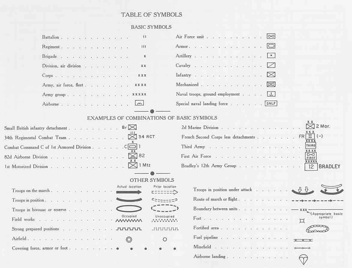
Table of Map
Symbols * |
|
|
| 1943-1945 |
|
Overview Map |
|
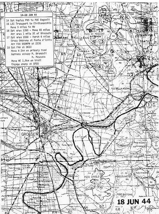
| 14-18 June 1944 |
"Engage Enemy at
0700" |
Battle Plan Map |
|
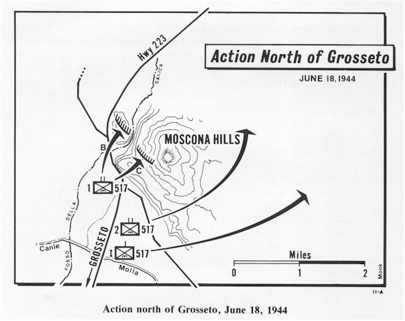
| 18 June 1944 |
North of Grosetto |
map |
|
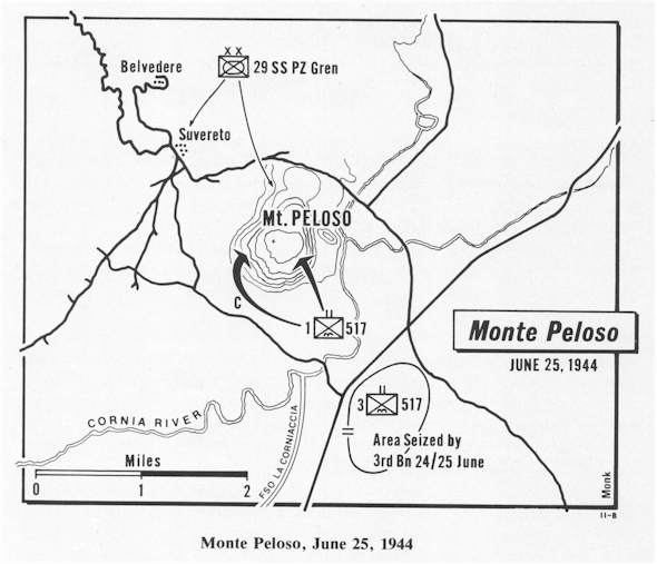
| 25 June 1944 |
Monte Peloso |
map |
|
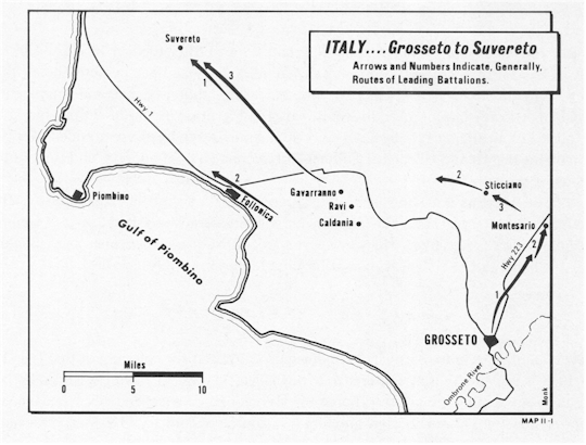
| Summer 1944 |
Italy - Grosseto to Surverato |
map |
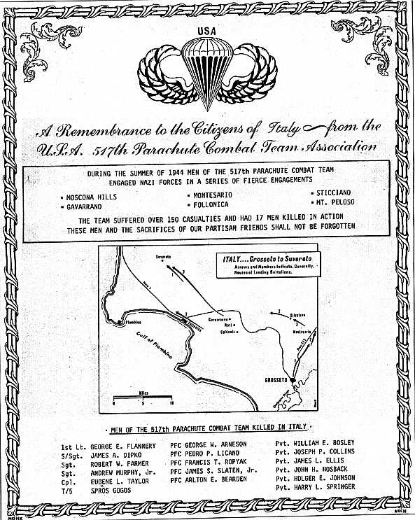
remembrance |
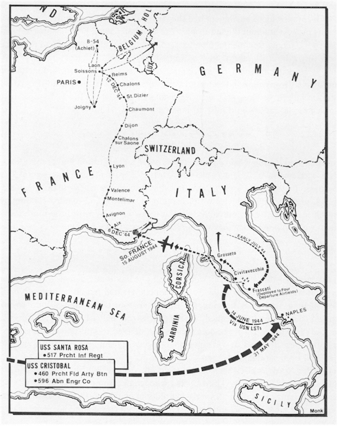
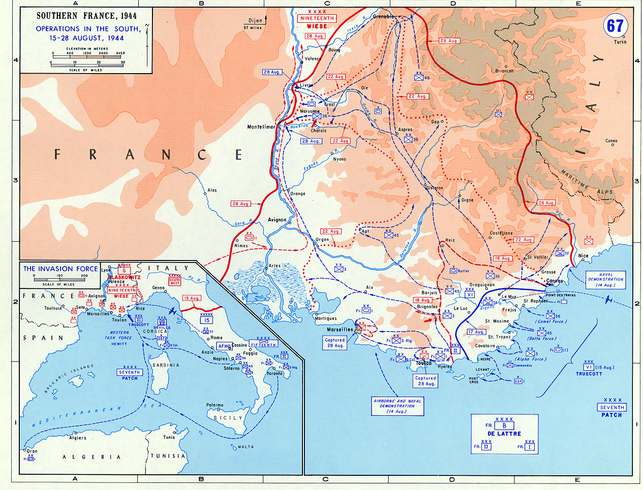
| 15-28 August 1944 |
Southern France overview, from
USMA * |
map |
|
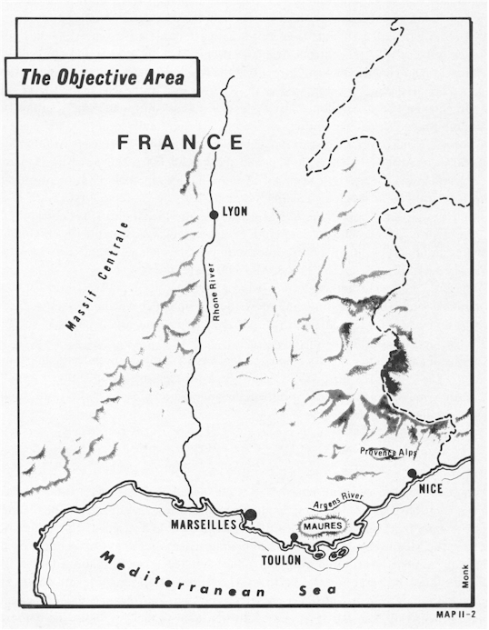
| 15 August 1944 |
Southern France - The Objective |
map |
|
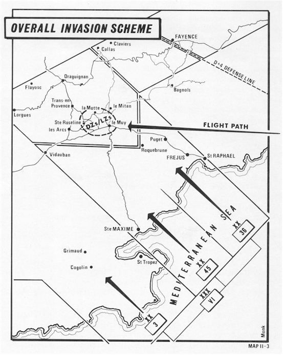
| Overall Invasion Scheme |
map |
|
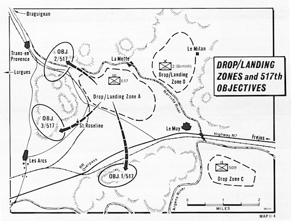
| Drop/Landing Zones and 517th
Objectives |
map |
|
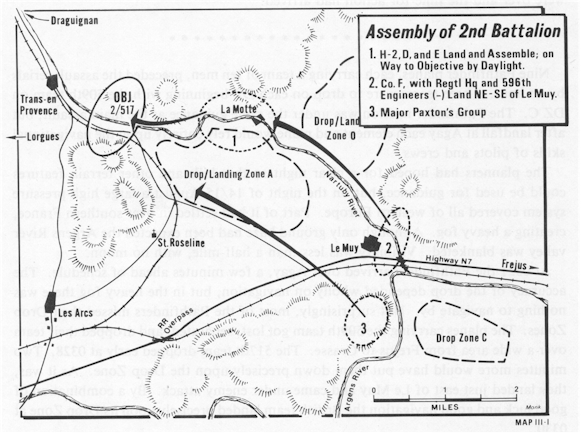
| Assembly of the 2nd Battalion |
map |
|
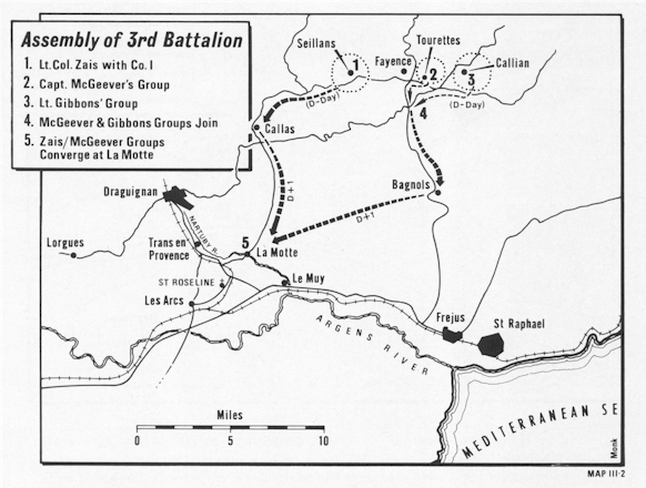
| Assembly of the 3rd Battalion |
map |
|
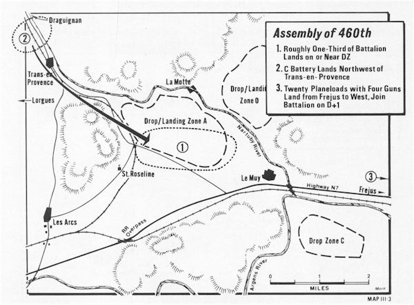
| Assembly of the 460th |
map |
|
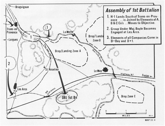
| Assembly of the 1st Battalion |
map |
|
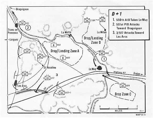
| 16 August 1944 |
D + 1 |
map |
|
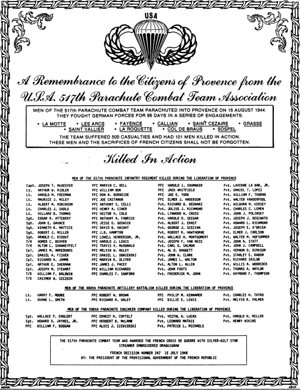
| Provence
KIA list |
A remembrance of those
killed in Provence |
|
remembrance |
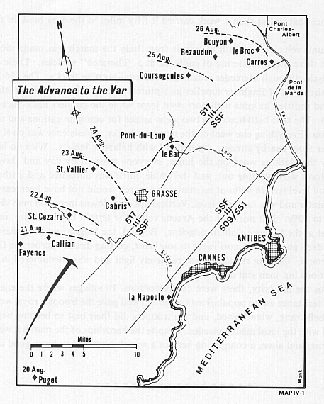
| 20-26 August 1944 |
The Advance to the Var |
map |
|
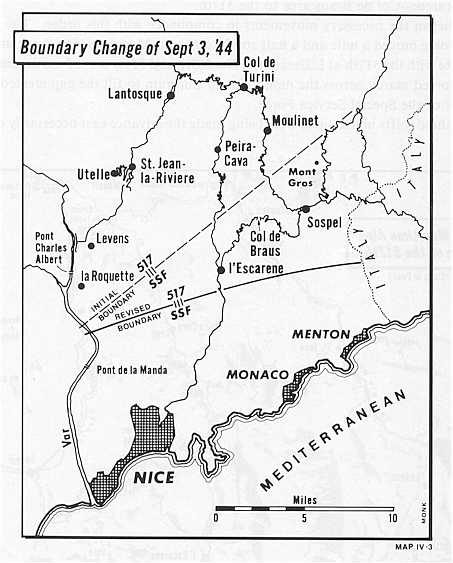
| 3 Sept 1944 |
L'Escarene, Col de Braus, Sospel |
map |
|
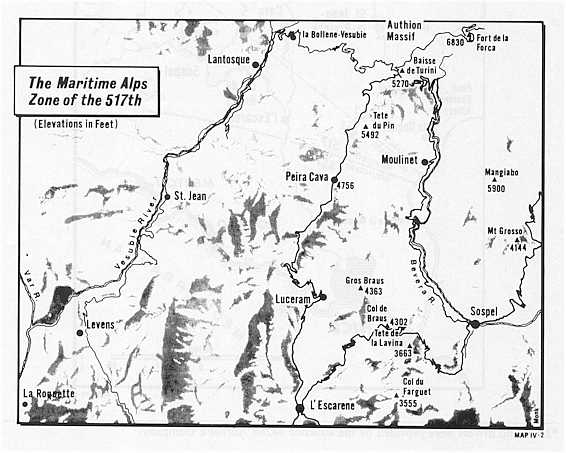
| Maritime Alps |
map |
|
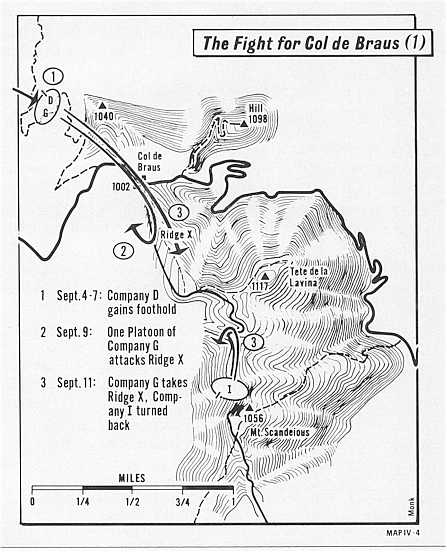
| 4-11 Sept 1944 |
The Fight for Col de Braus (1) |
map |
|
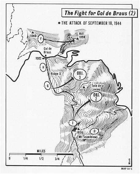
| 18 Sept 1944 |
The Fight for Col de Braus (2) |
map |
|
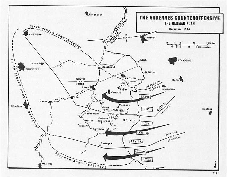
| December 1944 |
The Ardennes Counteroffensive |
map |
|
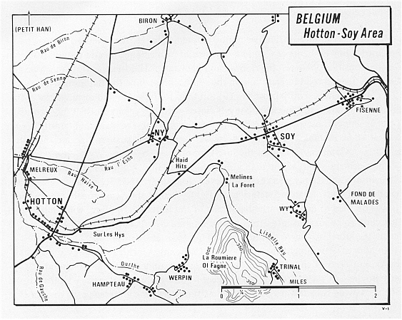
| December 1944 |
Belgium - Sotton-Hoy overview |
map |
|
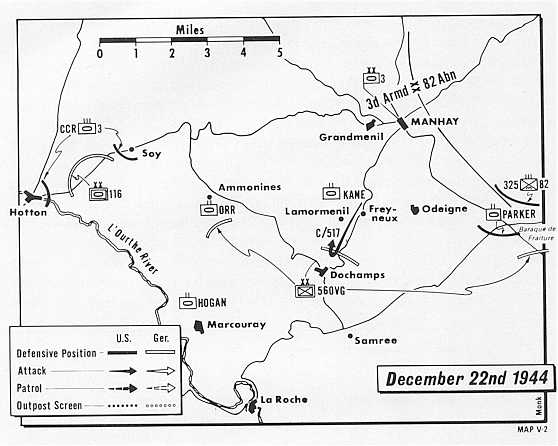
| 22 Dec 1944 |
The Ardennes |
map |
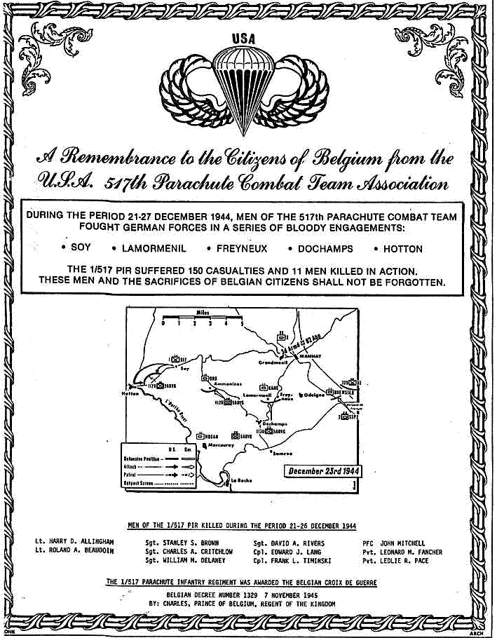
remembrance |
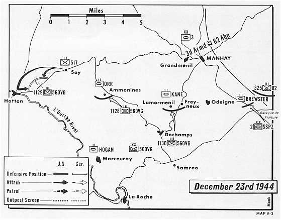
| 23 Dec 1944 |
map |
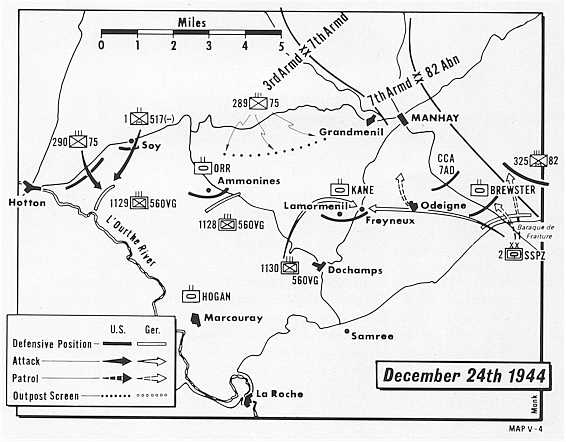
| 24 Dec 1944 |
map |
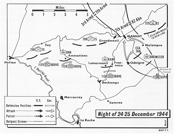
| 24-25 Dec 1944 |
The Ardennes, Manhay |
map |
|
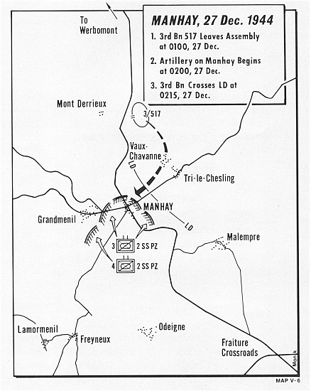
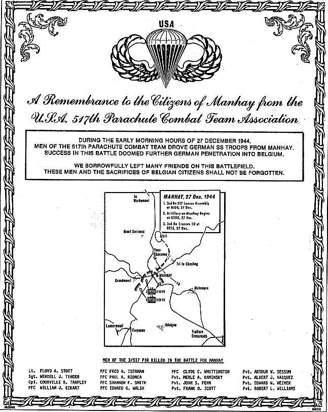
| 27 Dec 1944 |
Manhay |
map |
remembrance |
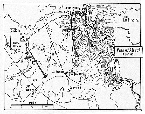
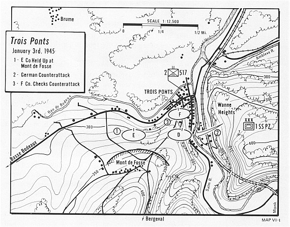
| 3 Jan 1945 |
Bergeval-St. Jacques |
map |
|
| 3 Jan 1945 |
Trois Points |
map |
|
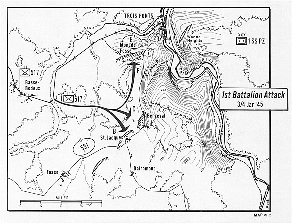
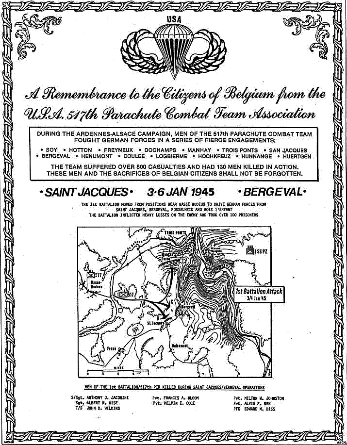
| 3-4 Jan 1945 |
1st Battalion Attack - Bergeval-St.
Jacques |
map |
remembrance |
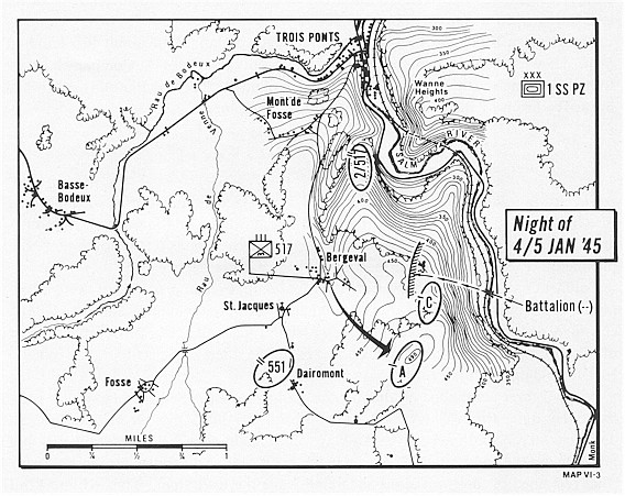
| 4-5 Jan 1945 |
Night of 4/5 Jan '45 |
map |
|
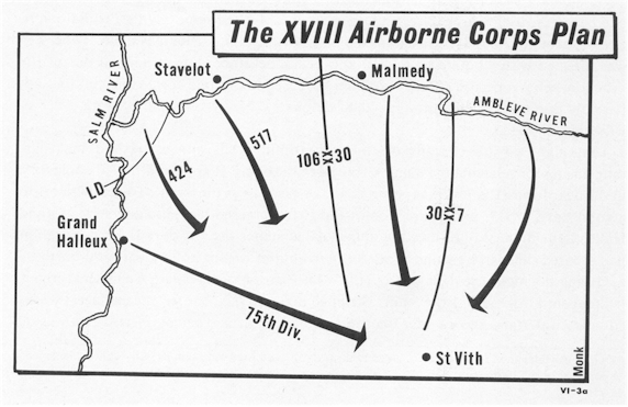
| 13 Jan 1945 |
The XVIII Airborne Corps Plan |
map |
|
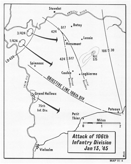
| 13 Jan 1945 |
Attack of 106th Infantry Division |
map |
|
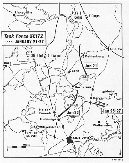
| 21-27 Jan 1945 |
Task Force Seitz |
map |
remembrance |
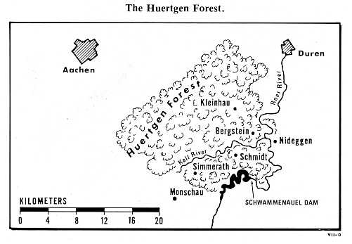
| |
The Huertgen Forest |
map |
|
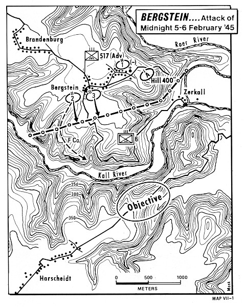
| 5-6 Feb 1945 |
Bergstein and Hill 400 |
map |
remembrance |
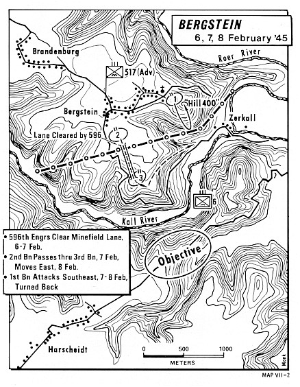
| 6-8 Feb 1945 |
Bergstein |
map |
|
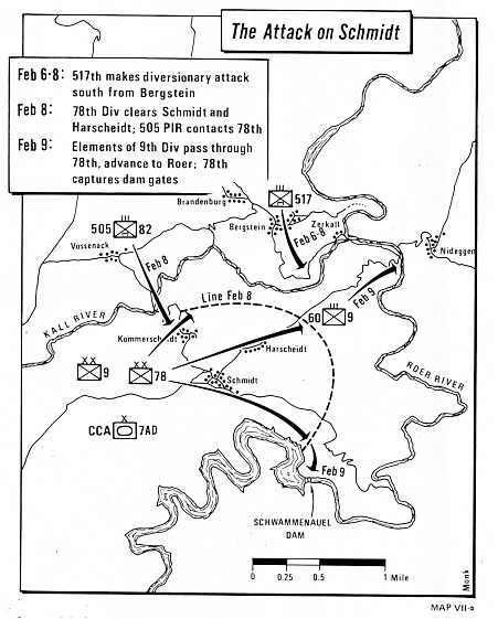
| 6-9 Feb 1945 |
The Attack on Schmidt |
map |
|

